Project — GIS System (GovTech)
Cadastral Boundary Update Tool
A map-based tool for generating and validating land parcel boundary updates.

Role
Product Designer
Platform
Desktop Web Application
Users
Cadastral officers
(expert GIS users)
Year
2026
- → Led discovery through interviews and workflow observation with cadastral officers and stakeholders
- → Structured user flows and interaction patterns for a map-based workflow. Then prototyped and designed them
- → Facilitated stakeholder alignment and iterated based on expert feedback
- → Produced implementation-ready designs and functional specifications
Overview
The Cadastral Boundary Update Tool enables a manual workflow for the officers within a largely automated system. The manual workflow to update cadastral parcel boundaries is part of the development of the information system for linking the Cadastre with the Estonian Topographic Database. This information system enables new automated services, improving data accuracy and reliability, meanwhile reducing reliance on manual surveying.
However, automated parcel boundary updates can fail or produce uncertain results, requiring officer review.
We designed a workflow and user interface for officers to configure and run the automation algorithms, assess geometry, verify data, and confirm legally valid changes.
Design Challenges
How might we...
..design a seamless workflow for officers to run automation, validate results, and confirm legally valid changes?
..help officers to detect land parcels that need recalculation and run the automation algorithms?
..enable clear, multi-level comparison of existing and proposed geometries, points, and metadata?
..help officers to explore and adjust point creation to ensure the geometry is valid and legally valid?
To address these challenges, I designed a multi-phased workflow that balances algorithmic speed with expert human control.
Workflow Structure
Detect
Identify parcels requiring attention through a thematic status layer.
Inspect
Read the spatial context from datalayers, basemaps, and orthophotos, then use info queries to inspect the parcel and its surroundings.
Configure
Adjust algorithmic tolerances and buffer variables manually.
Analyze
Trigger the calculation and generate proposed border points.
Review
Study stable, new, and deleted points to ensure topological integrity.
Generate
Finalize the new geometry points and metadata.
Validate
Verify the metadata.
Decide
Accept into cadastre or request further manual adjustment.
Mapping System Logic to Interface Design
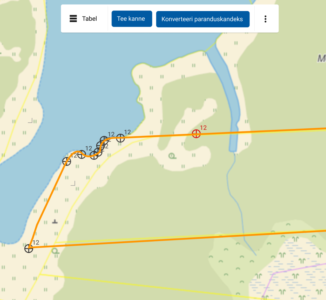
The stages defined above are realized through a unified GIS environment. The following visual walkthrough details the actual user journey from identifying a change to accepting the updated boundary.

Interface Review
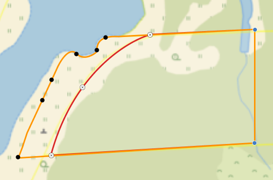
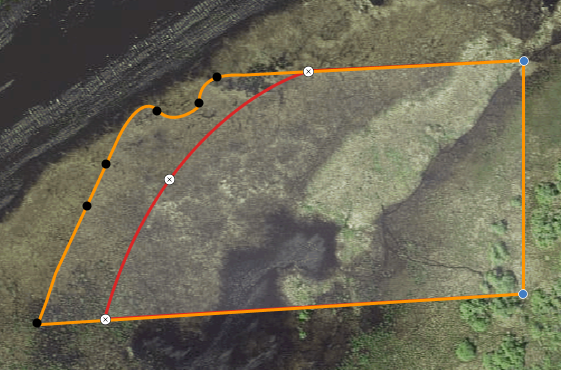
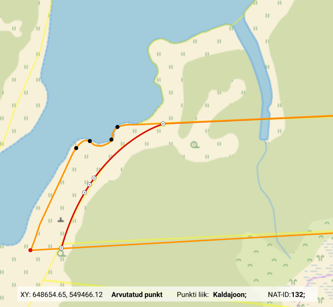
Overlay Comparison
Old and new geometries are clearly distinguished, enabling rapid change detection and point-level validation of spatial accuracy.
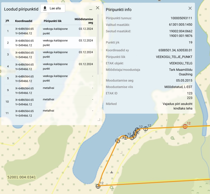
Metadata Verification
Granular data access at the vertex level. Every coordinate point is auditable, showing technical metadata for legal validity.
Final Decision
After metadata verification, the map interface presents two primary actions: accept the update into the national cadastre or route the task for manual correction.
Validation & Readiness
-
Validated with expert users
Workflow reviewed and refined through demo sessions with cadastral officers and stakeholders.
-
Aligned with technical requirements
Ensured the workflow reflects algorithm behavior, data requirements.
-
End-to-end workflow defined
Structured a complete process for handling failed or uncertain automated boundary updates.
Enabled consistent, defensible decision-making for automated cadastral boundary updates.